The Routes at a Glance
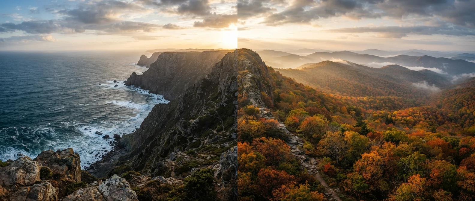
The Pacific Coast Highway (CA-1) stretches roughly 650 miles along California's shoreline, connecting the San Francisco Bay Area to the Los Angeles basin. It's a road defined by contrast - redwood-shadowed curves giving way to exposed, wind-battered cliffs above turquoise water. The Blue Ridge Parkway runs 469 miles through the southern Appalachians, linking Shenandoah National Park in Virginia to Great Smoky Mountains National Park in North Carolina. Conceived during the New Deal era as a scenic motor road, it was engineered specifically to slow drivers down and connect them to the landscape - no commercial trucks, no billboards, and a maximum speed of 45 mph throughout.
Both are federally managed and free to drive, though some adjacent parks charge entrance fees. If you're new to America's protected lands, our first-timer's guide to US national parks is a useful primer before you set out.
| Criterion | Pacific Coast Highway | Blue Ridge Parkway |
|---|---|---|
| Total Length | ~650 miles | 469 miles |
| Region | California coastline | Virginia & North Carolina mountains |
| Speed Limit | Varies (up to 65 mph) | 45 mph maximum |
| Peak Season | Spring & early fall | October (fall foliage) |
| Road Closures | Landslides (mainly Big Sur) | Ice & snow (winter, high elevations) |
| Urban Access | Frequent (SF, Monterey, LA) | Limited (Asheville, Roanoke) |
| Toll / Entry Fee | Free to drive | Free to drive |
| Dominant Scenery | Ocean cliffs & beaches | Forest ridges & mountain meadows |
Scenery, Terrain, and Driving Experience
PCH's signature is its oceanfront exposure. From the fog-laced bluffs of Marin County to the golden sea stacks of Big Sur, the route never lets you forget you're at the edge of a continent. Pullouts allow you to stop above waves crashing against rocks 200 feet below - it can feel exhilarating and slightly vertiginous in equal measure. Road widths narrow significantly through Big Sur, so larger vehicles require careful navigation. Seasonal closures due to landslides are not uncommon; always verify current conditions before departing.
The Blue Ridge Parkway offers a completely different sensory experience. Enclosed by dense hardwood and conifer forest for much of its length, the road opens periodically to broad ridge-top meadows and long-distance views across folded mountain layers. Mileposts count down from zero in Virginia - a quirky tradition that gives the drive a meditative quality. Wildlife sightings, including deer, black bears, and wild turkey, are frequent enough to warrant genuine caution at dawn and dusk. The practical checklist for unfamiliar US regions is worth reviewing for either route, especially regarding weather preparedness.
469 mi
Blue Ridge Parkway total length
Completed in 1987 after 52 years of construction, the Parkway is managed by the National Park Service.
~16M
Annual Blue Ridge Parkway visitors
The Blue Ridge Parkway consistently ranks among the most visited units in the National Park System.
90 mi
Big Sur's remote coastal stretch on PCH
This isolated segment has limited services and is subject to periodic closure due to landslides and erosion.
Seasons and Timing
Timing matters enormously on both routes. PCH is generally driveable year-round, but summer fog is a genuine factor in northern California - it can muffle the very views you came to see. Spring (April-May) and early fall (September-October) tend to offer the clearest skies and manageable crowds. Summer weekends around Big Sur can mean backed-up traffic at key pullouts.
The Blue Ridge Parkway has a more dramatic seasonal personality. Winters bring ice and frequent section closures, particularly above 4,000 feet - the National Park Service posts real-time closure information online. Spring wildflower season is quietly spectacular and underappreciated. Summer is lush and green, with comfortable temperatures at elevation. But October is the route's undisputed headline act: the hardwood canopy ignites in amber, crimson, and gold, drawing visitors from across the country. If fall foliage is your goal, weighing off-season travel trade-offs can help you decide whether shoulder-season visits make sense for your schedule.
Planning Considerations
On PCH, urban infrastructure makes logistics relatively straightforward. Fuel, lodging, and dining options appear frequently, especially between Santa Cruz and Santa Barbara. The isolated Big Sur stretch - roughly 90 miles - is the notable exception, so fuel up before entering and carry water. Cell coverage can drop in canyon sections.
The Blue Ridge Parkway demands more self-sufficiency. Gas stations within the parkway boundaries are few and often seasonal; plan to fuel in adjacent towns. The route passes through or near Asheville, North Carolina, and Roanoke, Virginia, both of which offer full amenities. Camping within the Parkway's own campgrounds is available, typically on a first-come basis, though some sites accept reservations. For travelers curious about other dramatic but less-traveled American landscapes - including coastal and mountain alternatives - our look at lesser-known US destinations may spark ideas beyond these two icons. And for a coastal wilderness experience of an entirely different scale, the Alaska Inside Passage offers a striking contrast to both.
Verify Conditions Before You Drive
Both routes are subject to seasonal closures and unexpected hazards. The National Park Service provides real-time road status updates for the Blue Ridge Parkway at nps.gov/blri. For PCH, Caltrans publishes current conditions and closures at quickmap.dot.ca.gov. Check both sources within 24 hours of your departure, particularly if traveling in winter or after heavy rainfall.